How Mathematics Is Useful In Landslide Risk Assessment: A Case Study Of Joshimath
Landslides are one of the most dangerous natural disasters that have a devastating impact on human lives and property as well. Landslide risk assessment is therefore an important field of study, and the use of mathematics and statistical analysis has become increasingly important in recent years. In this article, we will explore the use of mathematics in landslide risk assessment, with a focus on a case study of Joshimath in Uttarakhand, India.

Landslide Risk Assessment In Joshimath
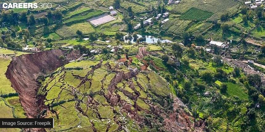
Joshimath is a small town in the Indian state of Uttarakhand, located in the Himalayan region. The town is located in a high-risk area for landslides, and several landslides have occurred in the past. In 2013, a devastating landslide occurred in the nearby town of Kedarnath, which claimed the lives of thousands of people. In 2017, a team of researchers conducted a landslide risk assessment in Joshimath using mathematical modelling and Geographical Information System(GIS). The study involved mapping the area using satellite images and field surveys.
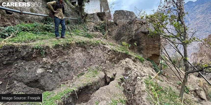
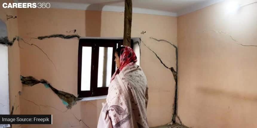
Recently in Joshimath, a significant number of houses began to exhibit cracks, indicating potential structural failure. A conference involving representatives from the state governments, the National Disaster Management Authority (NDMA), the Geological Survey of India (GSI), and the National Institute of Hydrology (NIH) recently concluded that the region is now considered a landslide and subsidence-affected zone.

Also Read | Unlock The Secrets Of Cryptography With The Help Of Mathematics
What Is Land Subsidence?
According to the National Oceanic and Atmospheric Administration (NOAA), subsidence is the sinking of the earth's surface caused by the movement of material below it. This phenomenon can occur naturally or as a result of human activities such as the extraction of water, oil, or other resources, as well as mining. The causes of subsidence are numerous and include earthquakes, soil degradation, and compaction of the soil.

What Is Landslide Risk Assessment?
Landslide risk assessment is the process of evaluating the probability and potential consequences of landslides in a particular area. The aim is to provide information that can be used to make informed decisions about land use and development. The assessment process typically involves mapping of the area, identification of potential hazards, and evaluating the vulnerability of buildings and infrastructure.
Mathematics Behind Landslide Risk Assessment
Mathematics plays a critical role in landslide risk assessment as it helps to quantify the likelihood and potential impact of a landslide. One important mathematical concept used in landslide risk assessment is probability theory. By analysing historical data on landslides and their associated conditions, statisticians can develop models that estimate the likelihood of a landslide occurring in a given area.
Also Read | Archimedes’ Principle Of Buoyancy – The Reason Why You Feel Weightless In Water
For example, let's consider a hypothetical landslide-prone area where previous data indicates that landslides occur on average once every five years. Using probability theory, we can estimate the likelihood of a landslide occurring in any given year as follows:
P(A)= Number of favourable outcomes for event ATotal number of possible outcomes
where P(A) is the probability of event A.
P(landslide in one year) = 1/5 = 0.2 or 20%
Another mathematical concept used in landslide risk assessment is slope stability analysis. Slope stability analysis involves assessing the forces acting on a slope and determining whether these forces are in equilibrium. If the forces are not in equilibrium, the slope may be at risk of failure. Slope stability analysis typically involves calculating a factor of safety (FS), which is the ratio of the resisting forces to the driving forces.

For example, let's consider a slope with a height of 10 metres and an angle of inclination of 30 degrees. The weight of the soil on the slope is 20 kN/m^3. Let's assume that the soil is fully saturated and has a cohesion (c) of 15 kN/m^2 and an angle of internal friction of 20 degrees. To calculate the factor of safety, we can use the following formula:
FS = (sum of resisting forces) / (sum of driving forces)
Two main forces, namely friction force and cohesion force, act to resist the sliding of land, therefore, resisting force is:
Resisting forces = cohesion x perimeter of the potential failure surface + tan x weight of the soil x area of the potential failure surface
Gravity is the main driving force for landslide, therefore, driving force is:
Driving forces = weight of the soil x area of the potential failure surface x sin
where is the angle of inclination of the slope.
After calculating the resisting and driving forces, we can plug in the numbers to find the factor of safety:
FS = (15 x 32.1) / (20 x 5 x sin(30)) = 2.92
A factor of safety greater than 1 indicates that the slope is stable, while a factor of safety less than 1 indicates that the slope is at risk of failure. In this example, the slope has a factor of safety of 2.92, indicating that it is stable.
Also Read | Cortisol - One Hormone That Can Cause Poor Digestion, Food Sensitivity, Memory Loss, And Inflammation
Relevance For Class 12 Maths Students
A case study of Joshimath can be relevant and useful for Class 12 maths students in several ways:
Real-world application: The case study demonstrates how mathematics can be applied in real-life situations, specifically in assessing the risk of landslides. This can help students understand the practical applications of mathematical concepts and how they can be used to solve real-world problems.
Multidisciplinary approach: The study involves the collaboration of mathematicians, geologists, and engineers, highlighting the importance of a multidisciplinary approach in solving complex problems. This can encourage students to broaden their perspectives and consider interdisciplinary approaches in their future studies and careers.
Statistical analysis: The study involves statistical analysis and modelling, which can be relevant to students studying statistics in class 12. It can help them understand the importance of data analysis and modelling in various fields, including natural hazards.
Awareness of natural hazards: The case study is based on assessing the risk of landslides, which is a common natural hazard in mountainous regions. By studying this case, students can gain awareness of the risks associated with natural hazards and the measures that can be taken to mitigate them.
Applications for Admissions are open.
As per latest syllabus. Physics formulas, equations, & laws of class 11 & 12th chapters
JEE Main Important Chemistry formulas
Get nowAs per latest syllabus. Chemistry formulas, equations, & laws of class 11 & 12th chapters
JEE Main high scoring chapters and topics
Get nowAs per latest 2024 syllabus. Study 40% syllabus and score upto 100% marks in JEE
JEE Main Important Mathematics Formulas
Get nowAs per latest syllabus. Maths formulas, equations, & theorems of class 11 & 12th chapters
